WEATHER-TRAFFIC UPDATE: House fires caused by lightning reported near Marietta, Dallas
ATLANTA FORECAST
Wednesday: High: 49
Wednesday night: Low: 50
Thursday: High: 65
» For a detailed forecast, visit The Atlanta Journal-Constitution weather page.
UPDATE [10:55 p.m.]: House fires caused by lightning have been reported in Cobb and Paulding counties.
Firefighters are on the scene of a blaze in the 4300 block of Oak Village Place near Marietta, Channel 2 Action News reported. No one was hurt during the incident. Firefighters are also fighting a fire at a home off Ivey Gulledge Road near Dallas.
We’re working to learn more about both fires.
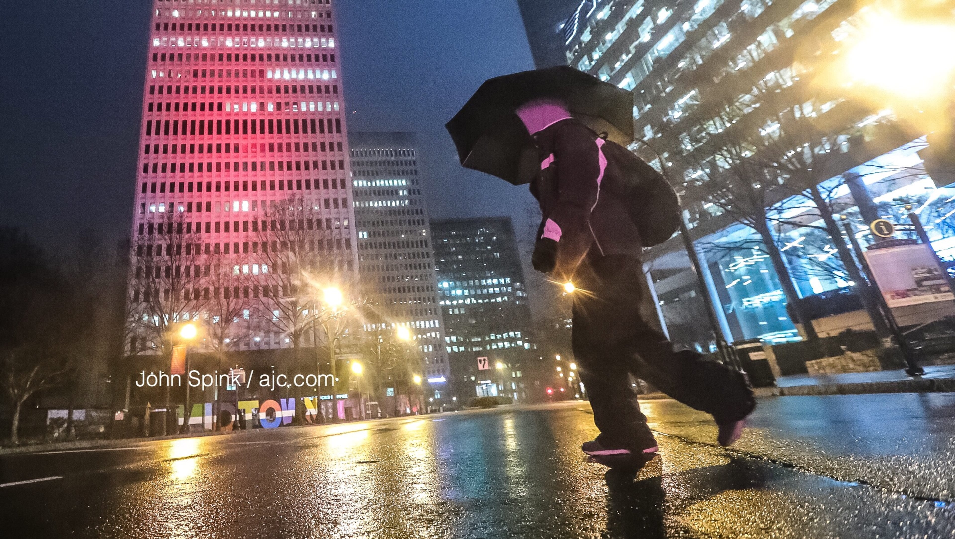
ORIGINAL STORY: Get ready. Another wave of storms is moving quickly toward Atlanta, and it's bringing heavy rain, lightning and possible hail with it, Channel 2 Action News reported.
Storms are racing east and northeast at 65 mph. That means the heavy downpours and lightning won’t last long over you. Light, moderate rain follows this evening. pic.twitter.com/6yvtwMjp1R
— Katie Walls (@KatieWallsWSB) February 20, 2019
All the while, a flash flood watch remains over all of metro Atlanta, according to the National Weather Service. A few north metro counties remain under a flood warning, including Catoosa, Cherokee, Dade, Floyd, Gordon and Whitfield.
“Soils have become very saturated across portions of North Georgia, mainly along and north of the I-85 and I-20 corridors,” the Weather Service said in an advisory. “Higher rainfall rates in combination with the saturated soils will increase the potential for flash flooding tonight through Thursday evening.”
RELATED: Everything you need to know about a flash flood
FLASH FLOOD WATCH has been issued, this replaces the flood watch and includes much of metro Atlanta.
— Brad Nitz (@BradNitzWSB) February 20, 2019
Details on the threats live on @wsbtv now. pic.twitter.com/wcpkKvZQTl
The low cloud cover and mist hanging around metro Atlanta is contributing to low visibility at times, according to Channel 2.
“Primarily what we’re dealing with is low cloud cover with some fog out there, but some actual showers, heavier at times, will build in later today,” Channel 2 meteorologist Brad Nitz said.
The low visibility could affect drivers, and the evening commute is beginning to slow a few areas, according to the WSB 24-hour Traffic Center. The increased volume is slowing the Northern Perimeter and the Downtown Connector, but wrecks are to blame for congestion on the Southside.
A right lane of I-675 South at Anvil Block Road is blocked by a crash in Clayton County, the Traffic Center reported.
Clayton Co.: Crash: I-675/sb at Anvil Block Rd.; blocks the right lane; delays; https://t.co/j2xHL1ZFrc; #ATLTraffic pic.twitter.com/3cKdUWcYWG
— AJC WSB Traffic (@ajcwsbtraffic) February 20, 2019
Earlier issues on I-20 West in DeKalb County have mostly cleared up after a crash near Panola Road blocked all but one right lane, the Traffic Center reported. All lanes have reopened and only minor delays linger.
A right lane of Peachtree Street at Deering Road is also blocked for construction, according to the Traffic Center.
Fulton Co.; Construction: Peachtree St./nb at Deering Rd.; blocks the right lane; delays; https://t.co/MhPvicYKPN; #atltraffic pic.twitter.com/sCLQKEyJPI
— AJC WSB Traffic (@ajcwsbtraffic) February 20, 2019
Atlanta has warmed up only a few degrees from its 40-degree start. It’s currently 45.
Several downed trees were reported Wednesday morning, including some in metro Atlanta. In DeKalb County, a tree fell on two cars as they entered the ramp to an Emory University Hospital parking deck. The drivers were able to walk to the hospital’s emergency room, according to Channel 2, and one person was treated for minor injuries.
RELATED: Tree falls on vehicles entering Emory University Hospital parking deck
WATCH: Tree falls on vehicles entering #Emory University Hospital parking deck - https://t.co/2cZZ7ZhL1Y #Atlanta pic.twitter.com/Nu8XLcfK7V
— John Spink (@johnjspink) February 20, 2019
Ferry Drive remains closed in Sandy Springs at noon while authorities clear another downed tree that took out power lines. Officials are asking drivers to avoid the area.
Tree and wires down - 6319 Ferry Drive. Please route around while GA Power repairs and tree is cleared pic.twitter.com/LpGM6MMNa0
— Sandy Springs, GA (@SandySpringsGA) February 20, 2019
In north Fulton, Willeo Drive was reopened after flooding closed the road near the Chattahoochee Nature Center.
Channel 2 meteorologist Brian Monahan said North Georgia still has a few more fronts to get through before the wet pattern breaks early next week. By then, an estimated 2 to 3 more inches of rain could fall, with higher accumulations possible in the mountain counties, he said.
Usually cold fronts help to clear the rain out, “but not this time,” Monahan said.
“This afternoon we've got a cold front coming in, rain is going to pick up,” he said. “It’s going to be heavy rain at times by tonight, and then this front is just going to get stuck by (Thursday).”
As the front stalls out, Monahan said it is expected to send wave after wave of rain across the northern half of the state.
The Gulf & the Pacific are open for business across the southeast... and that means more heavy rain is coming!
— Brian Monahan, WSB (@BMonahanWSB) February 20, 2019
Updating that part of the forecast now through 7am with @KarenMintonWSB on @wsbtv. pic.twitter.com/a1TcblZkSD
All this rain has taken care of Atlanta’s pollen problems for a while, Channel 2 meteorologist Karen Minton said. Pollen on Tuesday surpassed 1,000 particles per cubic meter of air, which is unusual for this time of the year. The count dropped drastically Wednesday to 2.
RELATED: Pollen count hits early high, but rain could spell allergy relief
POLLEN COUNT: The rain yesterday took care of our pollen problems for awhile. We will stay on this wet track for several days which will help keep the pollen low. pic.twitter.com/SLbrRow4V2
— Karen Minton (@KarenMintonWSB) February 20, 2019
Temperatures are expected to stay on the cold side Wednesday. By the afternoon, Atlanta should only warm up to about 49 degrees, according to Channel 2. Temps should break into the low 50s overnight.
“We're going to keep our warmer temperatures for later this evening, tonight actually, as things start to warm up a bit,” Minton said.

» For updated traffic information, listen to News 95.5 and AM 750 WSB and follow @ajcwsbtraffic on Twitter.
» Download The Atlanta Journal-Constitution app for weather alerts on-the-go.
About the Authors


Zachary Hansen, a Georgia native, covers economic development and commercial real estate for the AJC. He's been with the newspaper since 2018 and enjoys diving into complex stories that affect people's lives.