Florence’s ‘catastrophic’ flooding continues as tropical storm crawls through S.C.
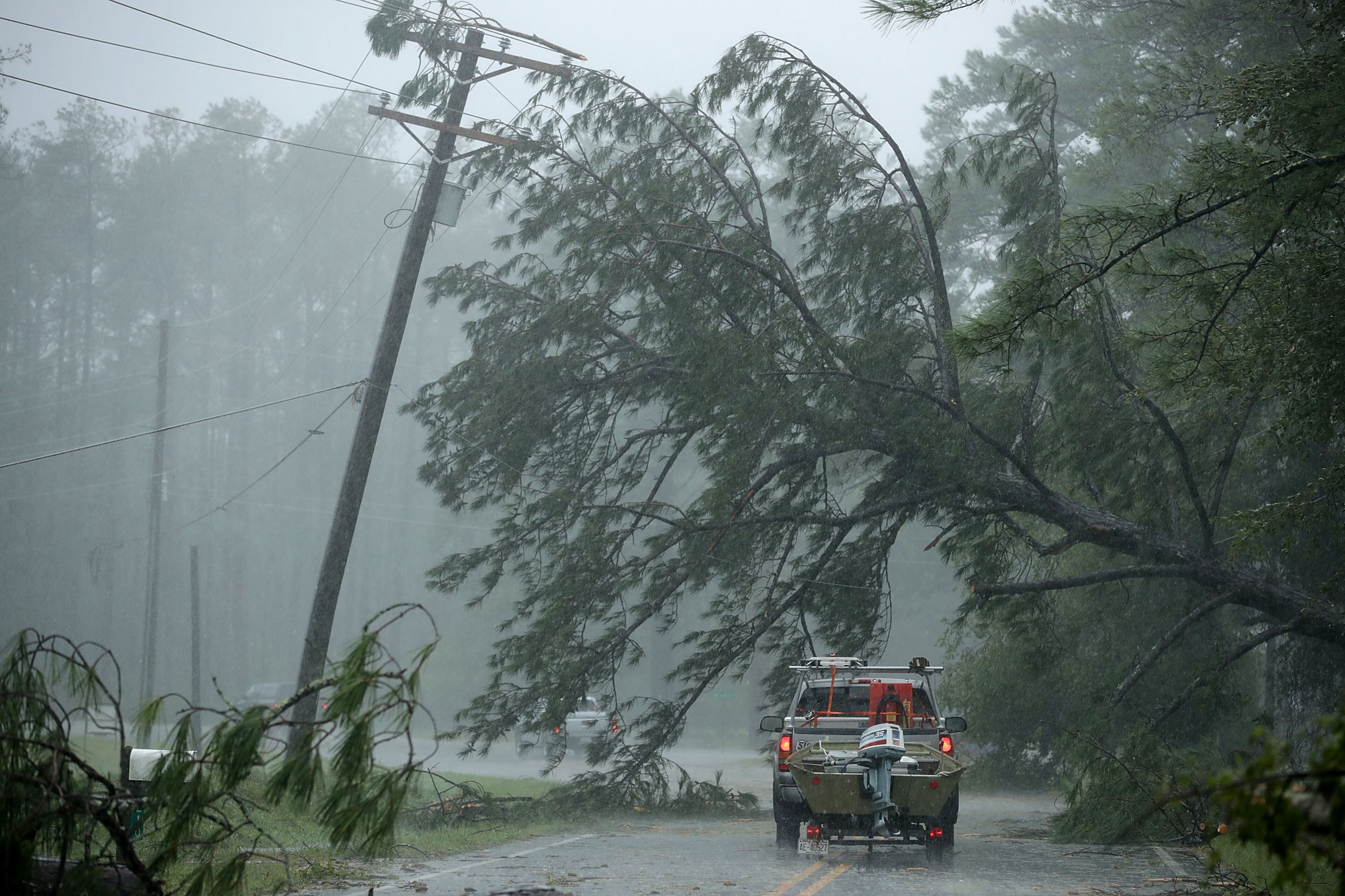
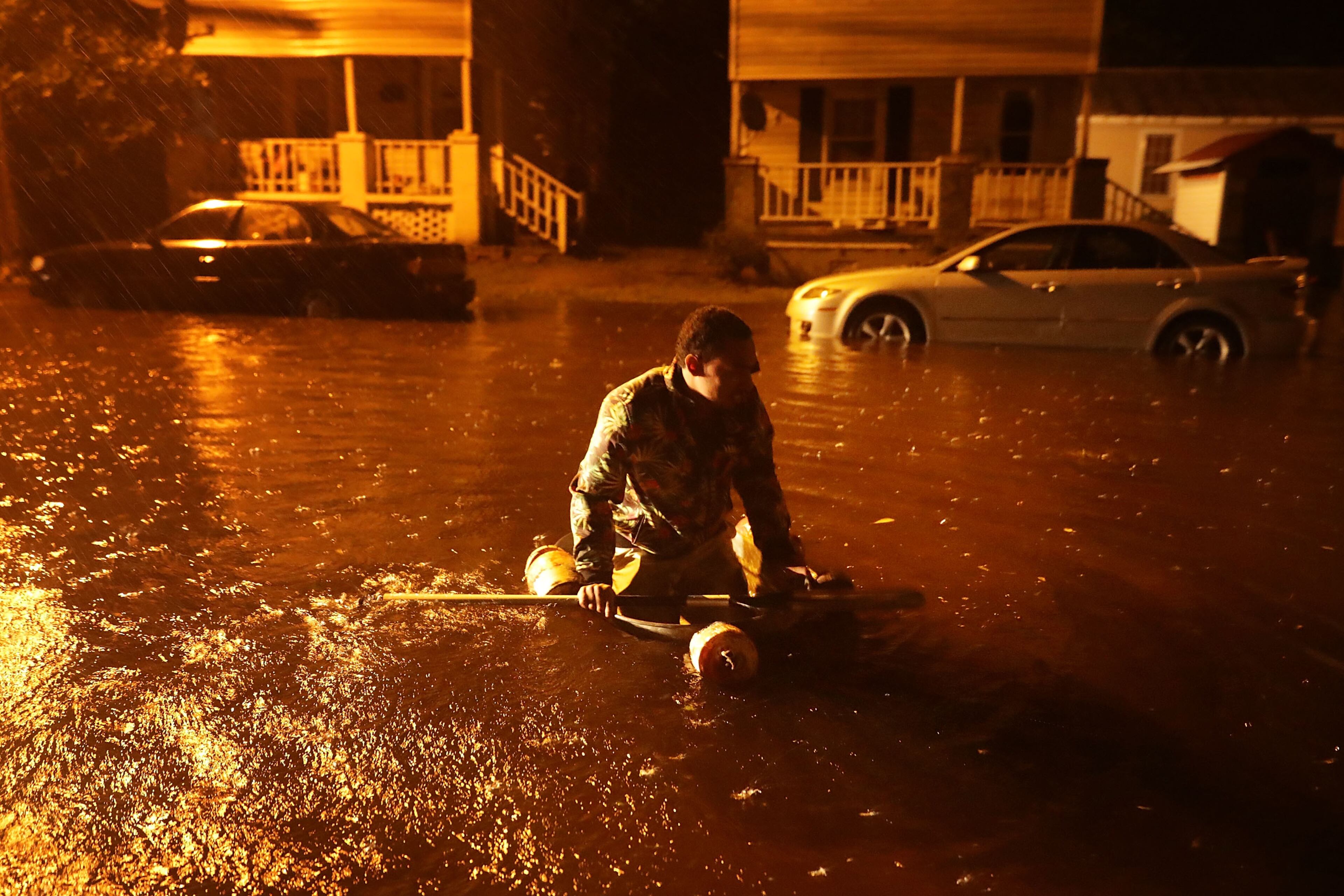
Tropical Storm Florence continues to slowly move through the Carolinas at 2 mph, drenching some cities with multiple feet of rain and causing "catastrophic" flooding, according to the National Hurricane Center's 5 p.m. update.
A few cities in North Carolina have reported over 23 inches of rain, and Swansboro, N.C. has seen a monstrous 30 inches of rain as of noon Saturday, Channel 2 Action News meteorologist Katie Walls said in a tweet.
Incredible rain totals coming out of NC, where another 10-20" are possible. We're getting in new information and video of the ongoing flooding and rescues. We'll have that for you tonight on the Nightbeat. #Florence pic.twitter.com/F1dzXfjR6a
— Katie Walls (@KatieWallsWSB) September 15, 2018
The storm’s continued slow moving speed has meant inch upon inch of rain continues to fall in the same areas.
"It's not a good update ... unfortunately the intimidating rainfall will continue for likely the next 24 hours or so — possibly even more,” Walls said.
5PM: Still Tropical-Storm #Florence continues its slow trek across eastern SC, producing heavy rains and catastrophic flooding in SC and NC. Some gauges in NC are now surpassing the 30" mark. Rivers may not crest until early week at record-levels. pic.twitter.com/KYYioeljRd
— Katie Walls (@KatieWallsWSB) September 15, 2018
At least eight deaths have been attributed to Florence so far in the Carolinas, according to ABC News.
The seven deaths in North Carolina include a mother and her infant who were killed in Wilmington, N.C., when a tree fell on their house, according to Wilmington police. The father was taken to a local hospital after being injured and freed by emergency workers.
Wind gusts in the city Friday were reported as high as 105 mph.
Officials in Union, S.C. said the state's first storm-related death was a 61-year-old woman who killed late Friday when her vehicle struck a tree that had fallen across S.C. 18., according to the Charlotte-based news station WSOC.
North Carolina Emergency Management said in a tweet that over 772,000 people are without power across the state around 11:30 a.m. Saturday.
Statewide power outage total at 11:30 am is 772,405 with the highest concentration in New Hanover, Brunswick, Columbus, Pender, Duplin, Onslow, Carteret, Cumberland, Moore, Robeson, Sampson, Wake counties. Get updates: https://t.co/Yx3twhyOqj
— NC Emergency Managem (@NCEmergency) September 15, 2018
Storm surges have receded some along the coast, but water levels are still up to four or five feet higher than normal in some areas, including Cape Lookout, N.C., and Myrtle Beach, S.C., the NHC reported at 5 p.m.
The tropical storm warning north of Cape Lookout and south of South Santee River were cancelled at 11 a.m. by the NHC. At 5 p.m., the tropical storm warning north of Surf City, N.C. along with all storm surge warnings were cancelled by the NHC.
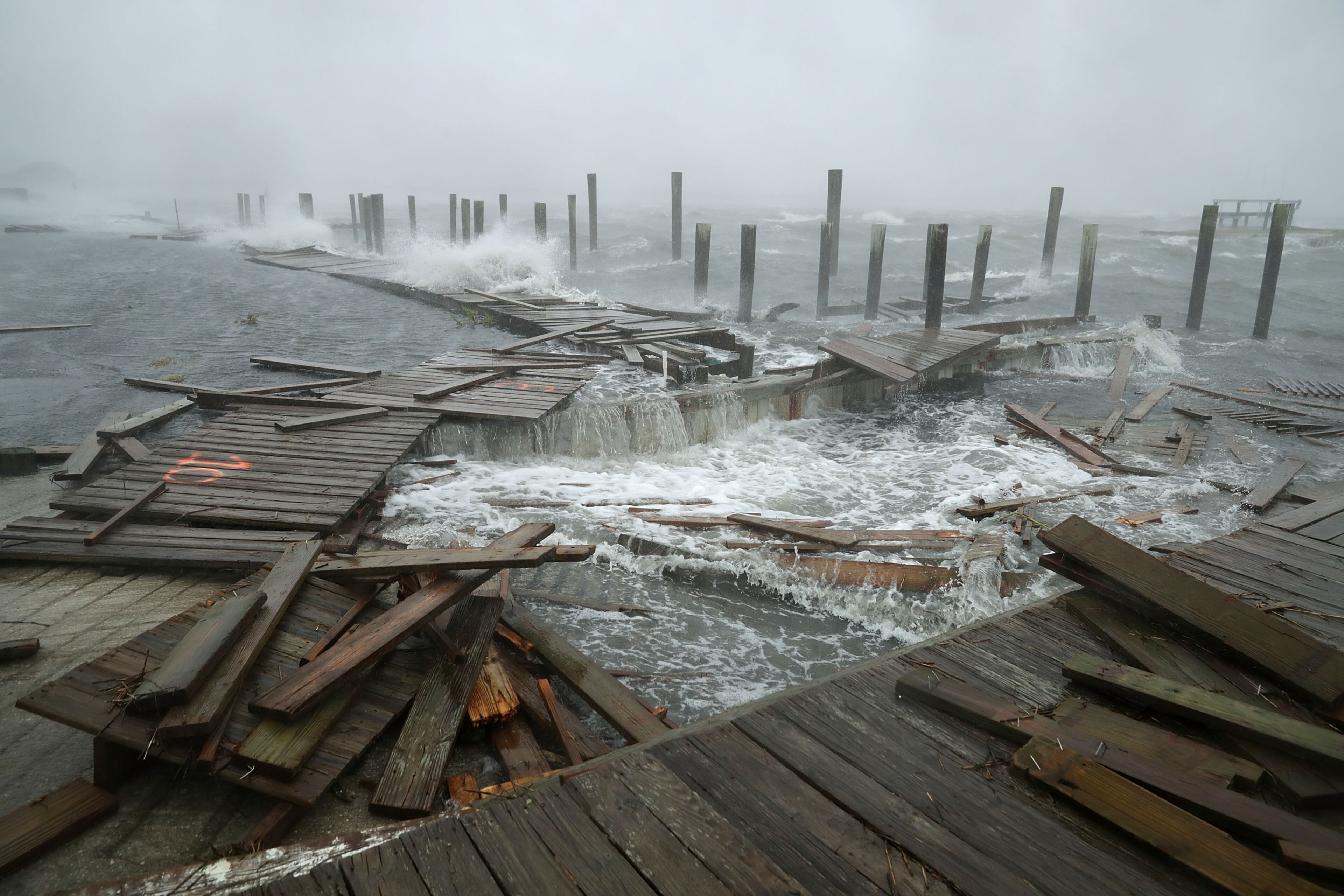
On Friday, North Carolina Gov. Roy Cooper said some storm surges have been as high as 10 feet.
Tropical Storm #Florence continues to cause catastrophic flooding in portions of North and South Carolina. pic.twitter.com/TapD87XJKB
— National Hurricane Center (@NHC_Atlantic) September 15, 2018
Despite the winds having weakened overnight, they’re still battering the Carolinas, downing trees and causing damage, Channel 2 reported.
“(The Carolinas) are dealing with intense bands of rainfall, and an additional 10 to 20 inches of rainfall is projected over the next couple of days,” Walls said.
Florence is currently about 60 miles west of Myrtle Beach and 44 miles southwest of Florence, S.C., the NHC reported. Given it’s 2 mph speed, it should remain in South Carolina until Sunday evening, the NHC reports.
Within the next 12 hours, Florence should be downgraded to a tropical depression, and eastern Georgia could start to see effects from the storm as it moves into western South Carolina.
RELATED: How are hurricanes categorized?
#Florence is forecast to be downgraded to a depression in the next 24-hours. Impacts in GA will be minimal. Greatest risk for rain and wind will be in NE GA. I'm updating that forecast NEXT at 6:15. pic.twitter.com/TiZJoCOeAj
— Katie Walls (@KatieWallsWSB) September 15, 2018
Walls said it isn’t likely North Georgia will get much rain when what’s left of Florence reaches the state Sunday. High winds are not a concern.
MORE STORM COVERAGE:
Some showers are likely Saturday night into Sunday, especially for the northeastern corner of the state. West Georgia may get little to no rain, according to Channel 2.
Rabun and Habersham counties are under a wind advisory until 8 a.m. Sunday by the National Weather Service. This means sustained winds of 20 to 30 mph are expected along with gusts up to 40 mph.
As #Florence slowly moves into western SC, our breeze will pick up, gusting to 20 mph in the Metro today and tomorrow. Up to 30 mph gusts are possible in East & NE GA closer to the center track. Rabun & Habersham are under a Wind Advisory for 40 mph gusts. pic.twitter.com/Sxbey8mtHq
— Katie Walls (@KatieWallsWSB) September 15, 2018
Gov. Nathan Deal declared a state of emergency for all of Georgia on Wednesday, citing concerns about high winds and torrential rain.
The University of Georgia moved up Saturday’s game against Middle Tennessee to noon due to the storm system.
About the Author

Zachary Hansen, a Georgia native, covers economic development and commercial real estate for the AJC. He's been with the newspaper since 2018 and enjoys diving into complex stories that affect people's lives.

