Light rain returns; sunny skies set for Friday
ATLANTA FORECAST
Today: Rainy and windy. High: 73
Tonight: Rain continues. Low: 60
Tomorrow: Sunny. High: 59
» For a detailed forecast, visit The Atlanta Journal-Constitution weather page.
Light rain has returned to metro Atlanta, but a break could be in store this weekend, according to Channel 2 Action News.
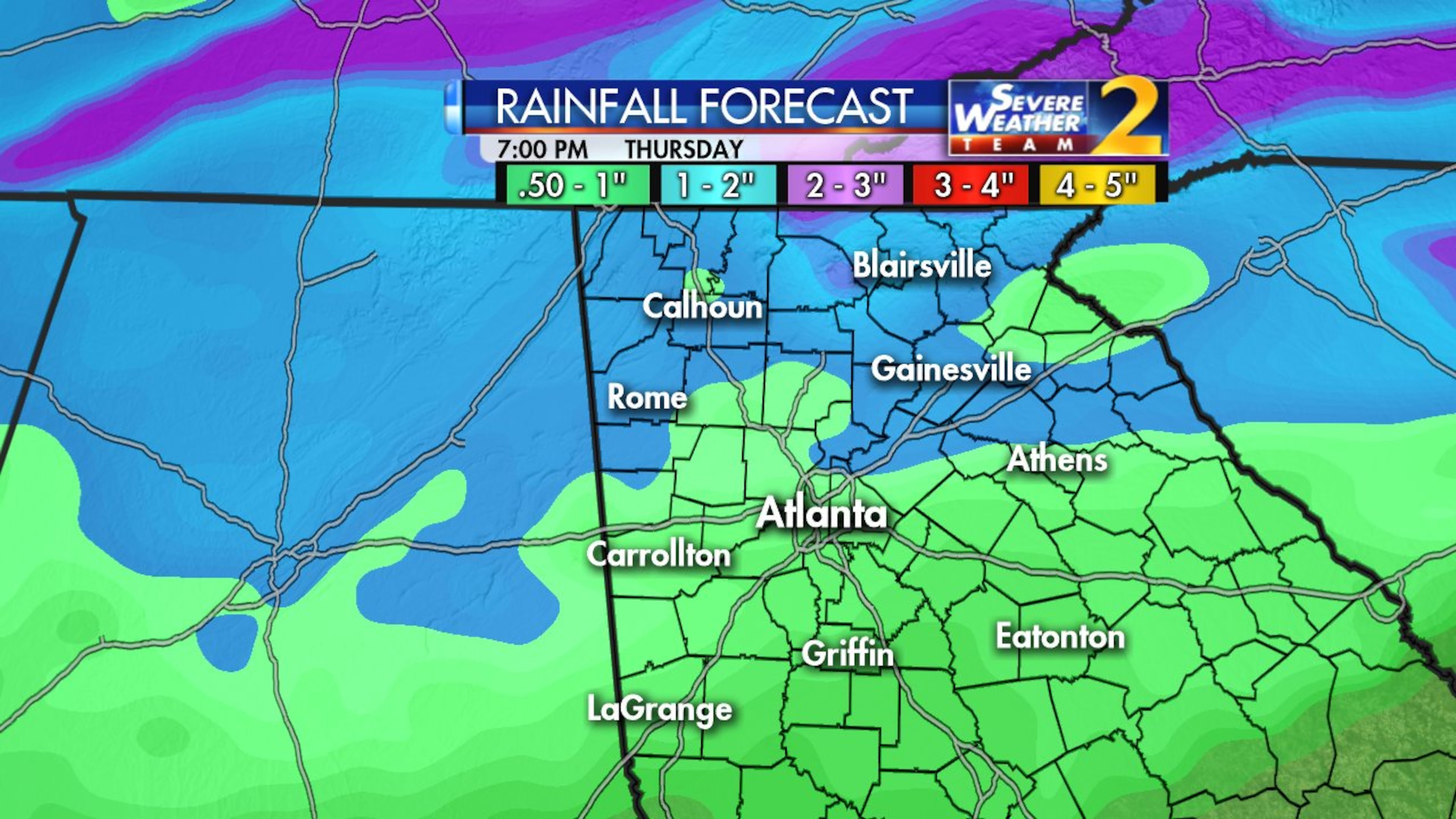
Light to moderate showers should last through Thursday evening, Channel 2 meteorologist Brad Nitz said. And a cold front has entered the metro area, triggering lower temperatures.
But the wet weather should subside by Friday, when clear skies are expected. Atlanta is expected to reach a high of 60, the average for this time of year.
Sunny skies and cool temps should last through the weekend.
Temperatures Thursday quickly surpassed the average high. It soared to 73 degrees early Thursday, then dropped 10 degrees as the first round of storms hit. It’s currently 56.
Gusts came close to 60 mph and a severe thunderstorm warning was issued just before 11:50 a.m. for Cobb, Fulton, DeKalb, Forsyth and Gwinnett counties.
At one point, the weather station at Channel 2 showed a rainfall rate of 3.69 inches per hour, Nitz said.
The National Weather Service even advised of an enhanced risk for a brief tornado in Barrow, Clayton, DeKalb, Fulton, Hall and Gwinnett counties.
But as quickly as the severe weather came, it went.
And by noon, the thunderstorm warning had expired.
A wind advisory that was in effect for the Southside of metro Atlanta expired at 6 p.m. Some gusts reached 35 mph.
WIND ADVISORY: Counties in blue under a wind advisory 10am-6pm today. Winds up to 35 mph possible. Rabun and Habersham (Yellow) in a HIGH WIND WARNING thru Saturday Noon. NW 20-30 with gusts to 60 mph. This could take out trees and cause power outages. pic.twitter.com/MMjQnoPgrx
— Karen Minton (@KarenMintonWSB) March 1, 2018
In far North Georgia, flooding is the lasting concern, Channel 2 reported. A flash flood watch for the area is scheduled to last until Thursday evening, according to the NWS.
FLASH FLOOD WATCH for mountain counties through this evening. An additional 1" of rain possible adding to the 1"-3" these areas have already received. Some rivers are already at flood. This will had more flood concerns. pic.twitter.com/c016LPzVgt
— Karen Minton (@KarenMintonWSB) March 1, 2018
“Flash flooding is a very dangerous situation,” the NWS said. “You should monitor later forecasts and be prepared to take action should flash flood warnings be issued.”