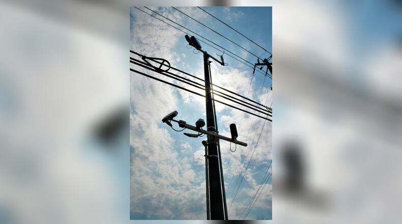
With a chill in the air and the potential for winter weather on the horizon, a new road sensor device in Brookhaven will help officials better judge the condition of the area’s streets, the city announced this week.
Brookhaven worked with the Georgia Department of Transportation to install the device. It’s the first GDOT-affiliated road sensor in metro Atlanta that is not located on an interstate or state highway.
Formally called a “Road Weather Information System,” the sensor station was recently installed at the busy intersection of North Druid Hills and Buford Highway. Leaders hope to use the technology to gather real-time data on the road’s surface and road sub-surface temperatures in addition to other weather-related conditions. That can be useful when the city has to decide whether to close government operations or issue alerts to residents during especially nasty weather.
Credit: City of Brookhaven
Credit: City of Brookhaven
Previously, Brookhaven had to rely on GDOT to issue reports reports on road conditions, the city explained in a statement. But, City Manager Christian Sigman said, “GDOT’s road sensors are mostly on interstates, and road sensor data from highways does not translate well to local street conditions.
“Knowing exactly what is going on with the roadway is the key to successful decision making,” he said.
The system was priced at $50,000; the cost was split between the city and GDOT.
The sensor is mounted on a utility pole near the intersection, and consists of thermometers, a wind sensor, a visibility sensor and an air pressure barometer. Additional sensors were installed in the street pavement along the bridge on North Druid Hills Road.
MORE LOCAL NEWS:
» Should Georgia legalize weed? Lower penalties for pot a growing movement
» DeKalb County elections 2019: Early voting starts Monday, Oct. 14
“It can play a role in a number of decisions such as proactively treating the roads, determining how quickly to mobilize street crews, alert the traveling public and encourage drivers to slow down in heavily affected zones,” the city said in a statement. It can also help determine whether the city should issue fog or hydroplaning alerts.
The data is also publicly available in real time on the National Weather Service's website, which offers a map of all the road sensors in the metro area. All of the other devices in the region are stationed on interstates or state highways, according to the map. Most are on I-75, I-85 or I-285.
“This information is critical year-round for reliably monitoring conditions from winter ice and snow storms to spring and summer flooding, hail storms, etc.,” said Paul White, Brookhaven’s emergency management coordinator.
Follow DeKalb County News on Facebook and Twitter
In other news:
About the Author


