Savannahians weigh in on billion-dollar fixes to too-low Talmadge Bridge
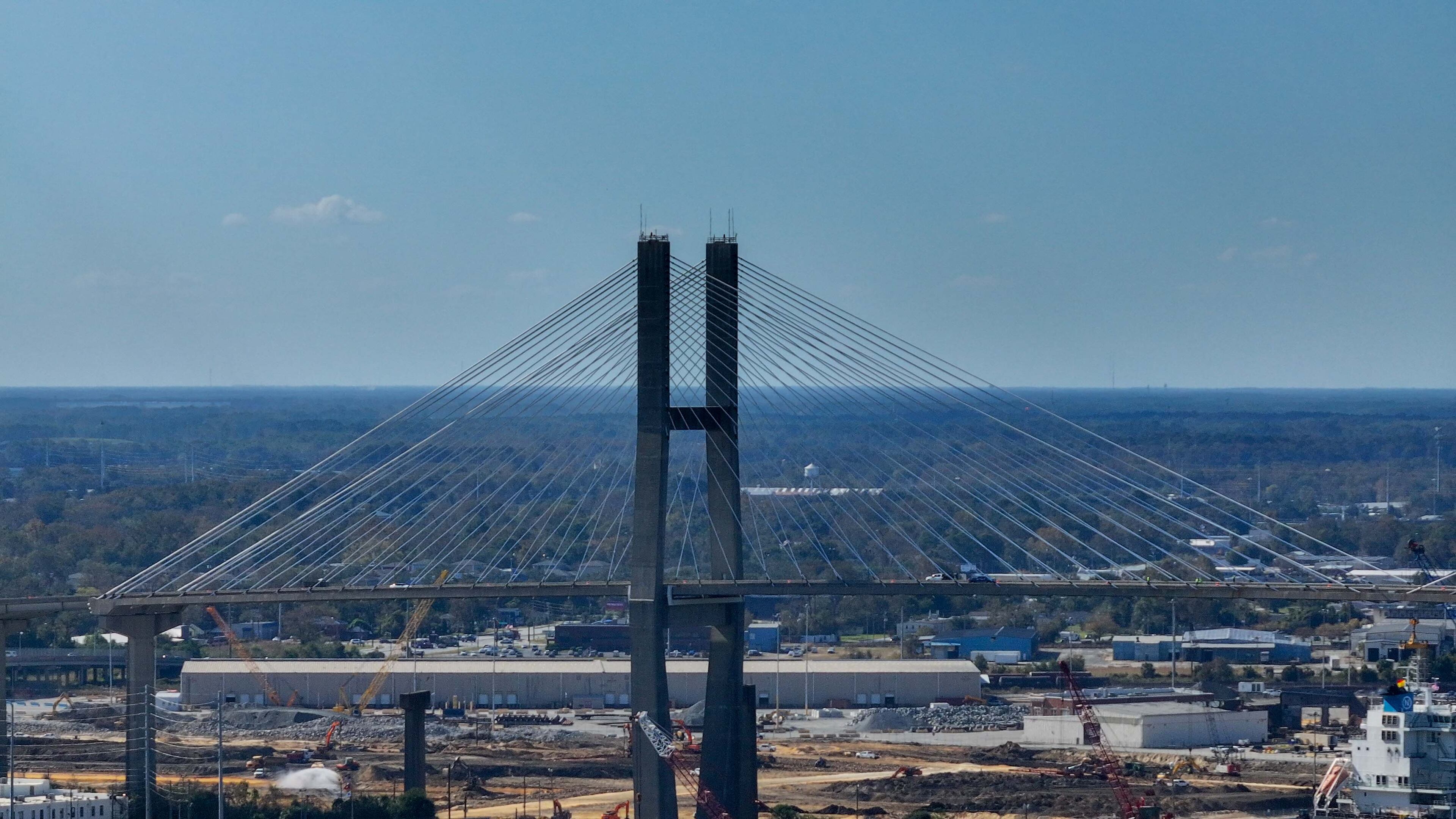
SAVANNAH — The Talmadge Bridge’s date with demolition is at least a decade away, but planning for the replacement of the iconic cable-stayed span on the edge of this city’s historic district is accelerating.
The Georgia Department of Transportation recently released maps detailing the paths of two proposed Savannah River crossings: a new, higher bridge, projected to cost $1.17 billion, and a $2 billion tunnel underneath the water. The most prominent new details include a relocation of where motorists get on and off the crossing in downtown Savannah and the steepness of the grade of a new bridge — 5.5%, the same as the existing span.
The plans were displayed Thursday night at a public open house in downtown Savannah that doubled as a public comment collection event. Several dozen residents turned out — significantly more than an open house held last summer — as did a handful of local officials, including two Savannah alderwomen and Chatham Commission Chairman Chester Ellis, the county’s most powerful decision-maker.
Most attendees offered written feedback. The comment period extends through March 27. Transportation officials said the comments, along with information gathered from stakeholder groups being convened regularly by Department of Transportation, will help determine whether a bridge or tunnel is built.
A decision is expected by the end of the year.
“A tunnel is the way to go, but I felt that way when they built the current bridge,” said Sam Youngblood, a Savannah resident who attended Thursday’s meeting. “My only question on that was whether it would affect the aquifer, and they’ve assured me it wouldn’t.”
The existing bridge opened in 1991 and replaced an older and much-lower bridge.
The Floridan aquifer, a giant underground reservoir, is Savannah’s main source of drinking water. The aquifer’s top layer lies about 200 feet below the bottom of the riverbed.
The bridge replacement planning update is the first since last May, when the project was first shown to the public. The unveiling came six months after a feasibility study, which looked at 27 bridge replacement alternatives and was funded by the Georgia Ports Authority, was reviewed and published by The Atlanta Journal-Constitution.
Calls for replacing the bridge date to 2018 and were prompted by concerns from the Georgia Ports Authority, operator of the nation’s third-busiest and fastest-growing cargo container port. Their facilities are upriver from downtown Savannah and ships must pass under the Talmadge to access the terminals. At the current height of 185 feet, the bridge’s car deck is too low for next-generation cargo ships and would limit traffic to the port in the future.
The first of these larger ships are already at sea. A maintenance project on the existing bridge that could elevate the roadway and add as much as 20 additional feet of clearance is underway and projected for completion in 2027.
Georgia’s ports support 609,000 jobs and contribute $171 billion in sales activity annually in the state, a 2024 study showed. The ports’ business has nearly doubled over the last decade, and officials have announced $4.1 billion worth of expansions that will boost container capacity to 12.5 million units by 2035.

Georgia Ports Authority’s property will figure prominently in the new crossing’s buildout, the traffic engineering plans displayed Thursday showed. The downtown Savannah interchange off the bridge or tunnel would move south from its current location at Oglethorpe Avenue to Louisville Road — directly adjacent to the gate for the authority’s Ocean Terminal.
The crossing’s north end, on Hutchinson Island in the middle of the Savannah River, is adjacent to a future ports terminal. That facility, known as the Savannah Container Terminal, is to open in 2030.
Should transportation officials decide to build a tunnel rather than a new bridge, both the south and north bores would be dug on port terminal properties.
Regardless of whether the new crossing goes over or under the river, it would provide convenient access for the ports. Cargo-carrying trucks would quickly access I-16 or U.S. 17, a four-lane road that links to I-95 about 15 miles north of the north end of the river crossing.

Some critics who turned out for the open house were spurred on by a well-known Savannah business owner, Reed Dulany. He started an opposition campaign last spring dubbed “A bridge too far Savannah” that encouraged state transportation officials to consider other locations for the crossing.
His push last year contributed to more than 800 comments being submitted during the initial public comment period.
Dulany, who did not attend Thursday’s meeting, renewed his call in recent months in advance of the current public comment period. He’s spoken at three Savannah-area neighborhood association meetings this year, pointing to how the current Talmadge Bridge cut off several westside residential neighborhoods from downtown when it opened in 1991, and that putting the new crossing in the same place would “cement that division.”
“How does it benefit Savannah?” Dulany said during a Downtown Neighborhood Association in February. “It benefits (the Georgia Ports Authority), but it doesn’t benefit Savannah.”
Dulany is pushing for a crossing east of downtown off the Truman Parkway, an 11-mile limited-access highway linking downtown to Savannah’s southside. Putting a bridge or tunnel there would benefit Dulany, who has several business interests, including a proposed private port terminal, near the Truman.
But an eastside crossing would allow for a “revisioning” of Savannah’s main gateway, Dulany said, by removing the Talmadge Bridge and its approaches and moving the I-16 terminus out of the downtown historic district. Currently, the interstate ends suddenly, spilling onto a street near the Savannah Civic Center.
About the Author

Adam Van Brimmer is a journalist who covers politics and Coastal Georgia news for The Atlanta Journal-Constitution.