Multiple tornadoes likely in Polk, Bartow and Coweta during overnight storms


Meteorologists at the National Weather Service said it is likely multiple tornadoes hit North Georgia overnight, including a “violent tornado” that ripped through downtown Newnan.
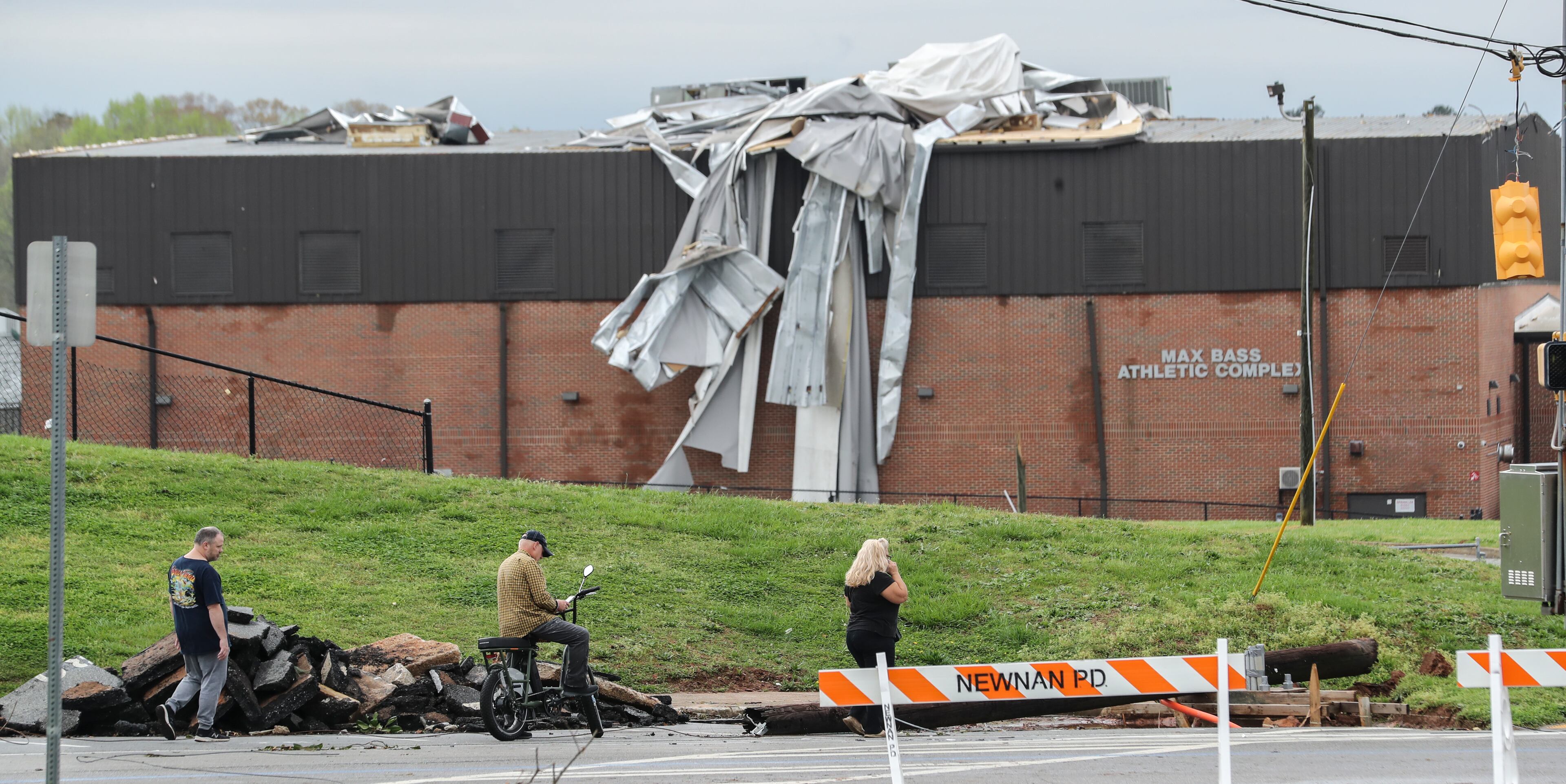
The long-tracked storm that crumbled buildings, ripped trees up by their roots and trapped people inside their homes in Coweta County is likely to be an EF2 or greater tornado, according to Keith Stellman, a meteorologist at the Weather Service’s Peachtree City office. It entered Newnan shortly after midnight, flooding the county’s 911 center with hundreds of calls for service.
One person was killed during that storm, Coweta officials said Friday.
Stellman said meteorologists were still conducting surveys to determine its path and top wind speeds. Surveys were also being conducted Friday in Cedartown and Cartersville in northwest Georgia, where he said it is possible multiple tornadoes hit late Thursday night.
The severe weather risk wound down before sunrise Friday.
“It’s been a rough night, a difficult night across North Georgia, but the severe weather risk is ending,” Channel 2 Action News meteorologist Brian Monahan said early Friday morning. “The tornado watch, that has ended. Our significant severe weather threat is over for now.”
The storms produced long-tracked tornadoes as they moved east across Alabama and into northwest Georgia on Thursday evening, according to Channel 2. The first tornado warning was issued about 12:30 p.m. south of Tuscaloosa, and Monahan said the same supercell storm was responsible for significant damage in Polk County when a possible tornado swept through about 5 p.m.
“This is a track of about 200 miles where we had at least an active tornado warning,” he said. “Just an incredible distance.”
In Coweta, officials are urging drivers to stay off the roads as work continues to survey storm damage.
At least five people were killed in the storms in Alabama. The Weather Service was expected to make a determination on the size and strength of any possible tornadoes later Friday.
Schools in Polk, Coweta and neighboring Bartow, Floyd and Heard counties are closed Friday due to storm damage. City of Calhoun and Gilmer, Gordon, Meriwether and Pickens counties delayed the start to the school day.
All across North Georgia, downed trees and power lines blocked roads Friday morning. Georgia Power was reporting about 13,000 customers without power as of 6 a.m., and another 3,200 outages were reported by Georgia EMC members.
A cold front sweeping by Friday morning cleared the storms away, giving North Georgia an opportunity to dry out. By the afternoon, Monahan said North Georgia should see a mix of clouds and sunshine and temperatures in the mid-70s. Atlanta’s projected high is 75 degrees.
Another cold front is headed for North Georgia on Sunday and will bring with it another chance of severe weather, according to Channel 2. The National Weather Service has categorized the threat as a Level 2 out of 5 for most of the region.
» For a detailed forecast, visit The Atlanta Journal-Constitution weather page.
» For updated traffic information, listen to News 95.5 and AM 750 WSB and follow @ajcwsbtraffic on Twitter.
» Download The Atlanta Journal-Constitution app for weather alerts on-the-go.
About the Author


