Wet weather pattern here for weekend with low severe storm risk
After a sunshine-filled Thursday, metro Atlanta is moving into a more active weather pattern starting Friday.
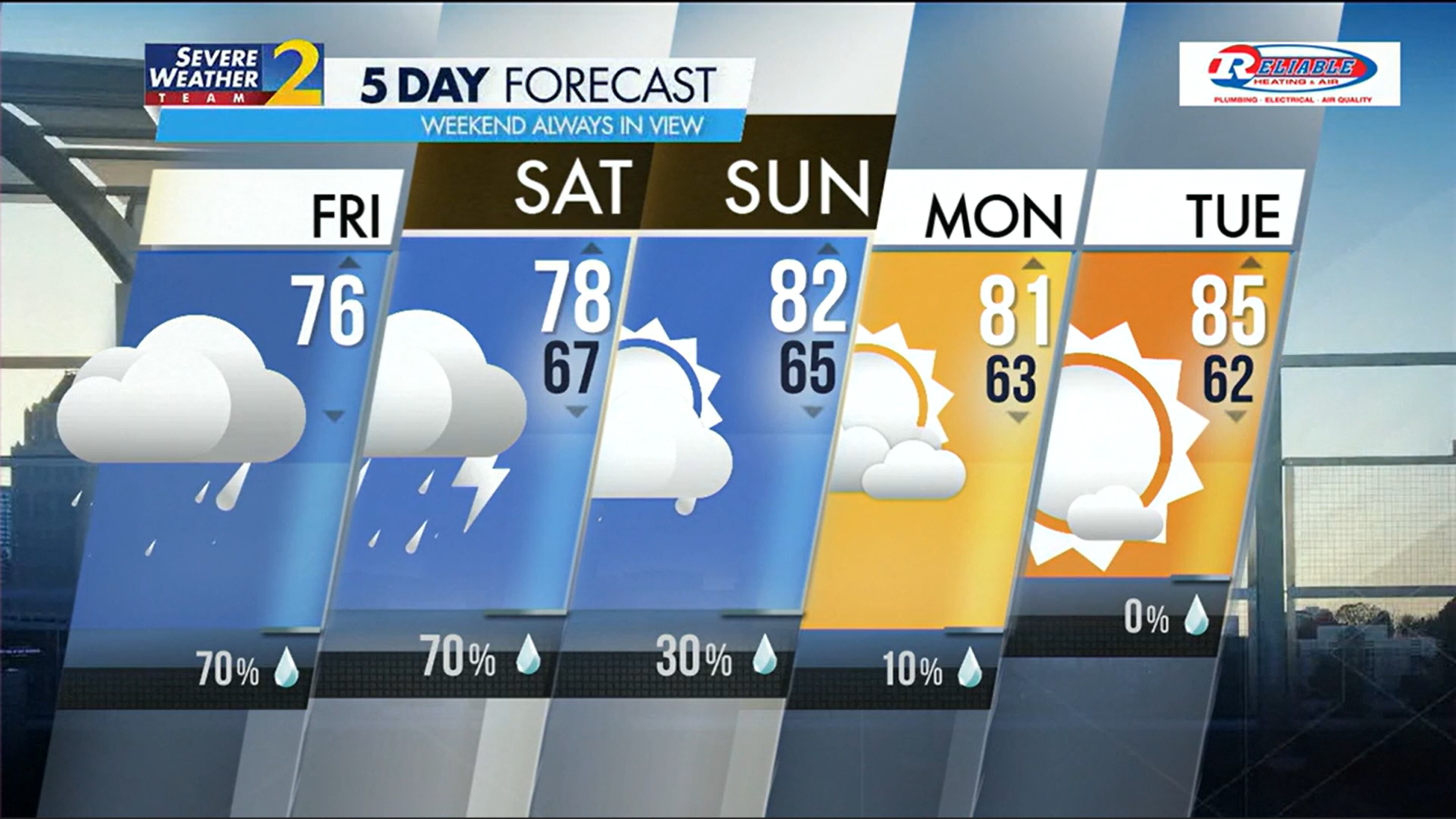
It’ll be slightly cooler today, too. Morning temperatures are in the 60s and highs will stay in the low 70s as opposed to the mid 80s.
As for rain, a few scattered showers are falling across the metro area this morning, and it’ll be off and on throughout the day.
“It will get wetter as the day goes on,” Channel 2 Action News meteorologist Brian Monahan said.
Some showers could turn into thunderstorms throughout the day. In Middle Georgia, however, there is a Level 1 of 5, or marginal, risk for severe weather, which increases to a Level 2 in the state’s far southwest corner.
Overnight and into Saturday morning, that marginal risk (Level 1) moves into the metro.
“As a warm front starts to lift across North Georgia, the air is going to become more unstable,” Monahan said.
Temperatures on Saturday are expected to climb into the upper 70s
Those storms could develop around the late morning hours and into the afternoon as temps top out in the upper 70s Saturday. The potential for stronger storms lingering into the evening and night, Monahan said.
“Then a cold front passes by and sets us up for a drier day on Sunday,” he said.
Skies will still be cloudy Sunday, but the rain chance falls to 30%. Without much rain to cool things down, highs will climb into the low 80s.
» For a detailed forecast, visit www.ajc.com/weather.
» For updated traffic information, listen to News 95.5 and AM 750 WSB and follow @WSBTraffic on X, formerly Twitter.
» Download The Atlanta Journal-Constitution app for weather alerts on-the-go.
About the Author

Rosana Hughes is an award-winning bilingual (fluent in Spanish) journalist with a passion for explanatory public service journalism. She has been a reporter on the breaking news team since January 2022.