Helene could trigger ‘life-threatening’ floods in Atlanta, North Georgia, forecasters warn
For the latest updates on Hurricane Helene, follow AJC’s live coverage and hour-by-hour forecasts.
Hurricane Helene will likely be a tropical storm when it hits Atlanta and North Georgia and is expected to “inundate communities in its path with flash floods, landslides, and cause extensive river and stream flooding,” the National Oceanic and Atmospheric Administration warned Wednesday evening.
The storm might lose a bit of its punch after making landfall in Florida on Thursday, but with a wind field stretching 275 miles from its core, the damage it will bring to the already rain-soaked area is predicted to be extensive, the agency said.
“Flooding from extreme rainfall is the deadliest direct cause of tropical cyclone fatalities in the U.S. over the past decade,” the NOAA warned in a rare news release that was titled: “Communities need to prepare for catastrophic and life-threatening flooding from Helene, even well after landfall.”
Atlanta may already have some flash flooding in store before Helene arrives due to heavy rain from another storm system that hit Wednesday and will last into Thursday.
Helene’s harshest impacts in the metro area and North Georgia are predicted to peak between Thursday afternoon and Friday afternoon, according to the National Weather Service. The entire area in the NWS map — from just south of Atlanta up through the state’s northern border — is in a flood watch from Wednesday afternoon to Friday afternoon, on top of a tropical storm watch over half the state.
Many metro schools announced plans to close either Thursday, Friday or both days.
North and Middle Georgia will likely have localized flash flooding before the arrival of Helene due to a separate storm system, with the greatest potential for flooding along the I-85 corridor, according to the NWS.
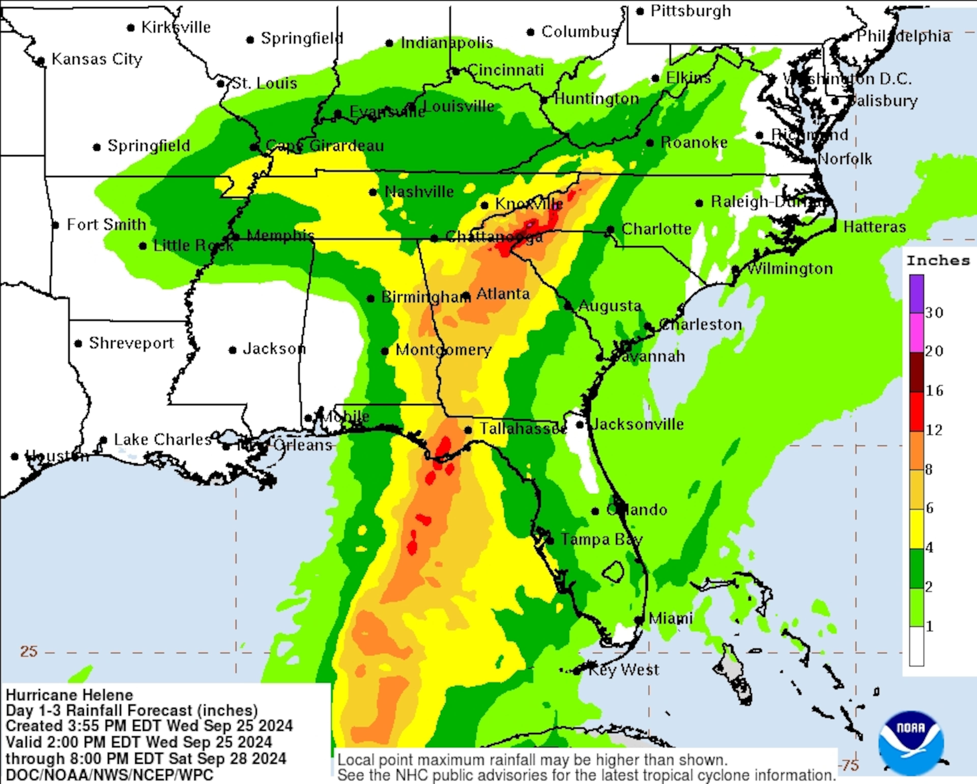
Most of that region is expected to get 6-12 inches of rain over the next few days, as of the federal agency’s 5 p.m. Wednesday forecast. The northeastern corner of the state could see 12-16 inches of rain, and some isolated areas could get up to 18 inches, according to the National Hurricane Center.
Thousands of power outages were also being reported across the state Wednesday afternoon.
Winds, rain and flooding likely
Damaging winds will also be carried “unusually far inland” by the storm due to its size and speed, according to the NWS. Wind speeds are expected to reach 60 miles per hour in the metro Atlanta area. Isolated tornadoes are also a possibility as the high wind conditions move inland.
South Georgia is currently under a hurricane warning. Helene strengthened into a hurricane late Wednesday morning, according to the National Hurricane Center.
National Weather Service meteorologist Meredith Wyatt, based in Peachtree City, said Helene will likely cause flash floods in the Atlanta area and across North Georgia.
Even before Helene moves into the metro area, a cold front over Alabama and western Tennessee brought a few inches of rain to the city on Wednesday. The region’s parched soils should be able to absorb most of that initial moisture, but it could mean they are saturated by the time Helene’s outer rainbands arrive late Thursday afternoon.
The storm is projected to drop an additional 4 to 8 inches of rain, with localized totals reaching 10 inches or more. That one-two punch will heighten the risk of flooding, Wyatt said, particularly in urban areas packed with impermeable roads and buildings, like Atlanta.
Metro Atlanta has experienced significant flooding during major storms in recent years, in part due to an aging stormwater infrastructure that often can’t handle heavy rains.
Sam Brody, the director of the Institute for a Disaster Resilient Texas at Texas A&M University, said even though huge federal investments are being made in stormwater and other infrastructure, those investments can’t keep pace with rapid development that is changing landscapes and making them more prone to flooding.
“Climate change is real, weather patterns are changing, but that is a big, slow variable, where a much quicker, more impactful variable is the human-built environment,” Brody said. “I worry that communities across America are looking up at the sky and saying, ‘oh, it’s global warming, what can we do?’”
Then there is the wind threat.
Wind gusts that could reach 60 miles per hour or stronger are expected in the Atlanta area from Thursday evening through Friday morning. After heavy rains have the loosened soils, Wyatt said Atlantans should expect to see downed trees and power lines.
“Coupled with the heavy rainfall, it’s not going to take much,” Wyatt said.
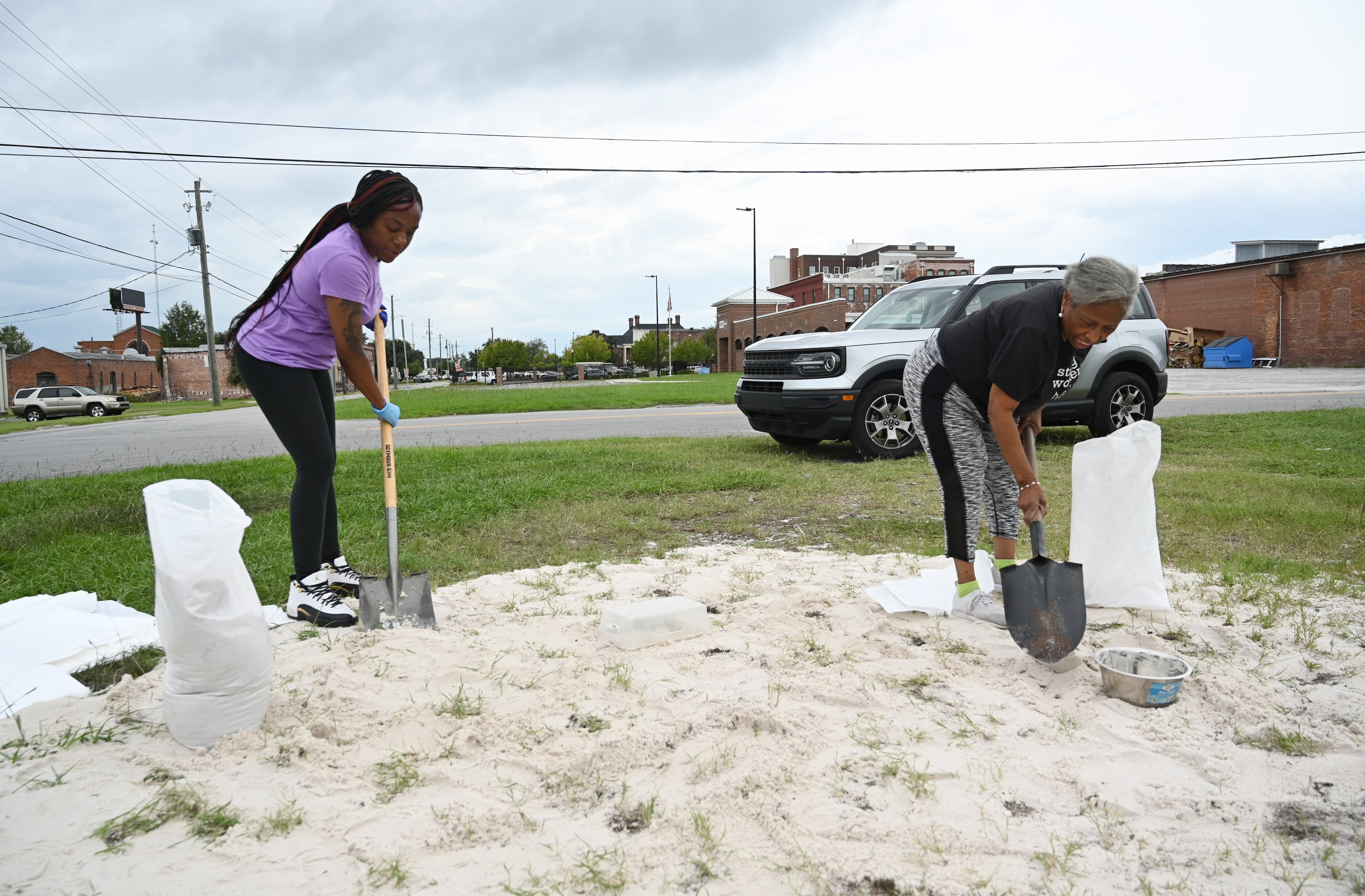
Amid flood and rain concerns, the Georgia Department of Agriculture urged the state’s farmers to prepare a plan to “keep your family and farm safe.”
Gov. Brian Kemp has ordered a state of emergency in preparation for the storm and its impacts and activated the State Operations Center, a multiagency center used to coordinate a response to disasters or emergencies with state, federal, local and volunteer agencies.
“The current forecast for Hurricane Helene suggests this storm will impact every part of our state,” Kemp said in a statement. “I have directed appropriate state agencies to work around the clock to ensure we’re prepared for whatever is heading our way.”
The Georgia Department of Transportation has activated all of its crews statewide, spokeswoman Natalie Dale said. GDOT is monitoring the forecasts and will shuffle where crews go Thursday based on the needs, she said.
In the metro area, she said crews started removing debris from roadways and clearing drains on Tuesday. They’ll keep doing sweeps throughout the week. They’ve also secured equipment at construction sites. Drivers should expect downed trees and standing water and avoid traveling if possible.
“If you don’t have to be on the road, stay off the road,” Dale said.
Power disruptions, school closures
Georgia EMC — which represents 41 electric membership corporations that provide electricity, mainly in rural parts of the state — said its members are prepared to respond to any power outages Helene may cause.
“EMCs around the state have activated their storm plans, and we are working together statewide to respond to the expected power outages caused by the storm,” Harry Reeves, Georgia EMC’s vice president of training and safety, said in a statement.
The group said its members started stockpiling poles, transformers, wire and other equipment in June, when the federal government first predicted this hurricane season could be the most active on record. It added that the EMCs have prepared trucks with emergency equipment and enlisted extra crews to help with the response.
As of 5 p.m., Georgia Power reported more than 4,500 customer outages across its network and Georgia EMC reported more than 12,500.
On Thursday morning, crews had addressed many of those outages. Georgia Power reported more than 1,900 outages and Georgia EMC reported more than 3,500 as of about 6:30 a.m. Thursday.
-Staff writer Sara Gregory and contributor Meris Lutz contributed to this report.
Hurricane Helene
Atlanta weather forecast and current conditions | Local weather radar
How you can help with Georgia storm assistance
Georgia statewide power outage map - live updating
Report power outages: Georgia Power Co. | EMCs for metro Atlanta
» Download The Atlanta Journal-Constitution app for news and latest weather alerts near you.
What we know about the victims in Georgia
Understanding the storm: Helene inflicted historic damage across Georgia
AJC video: After Hurricane Helene, repair and recovery begins in Georgia
Regional storm reports from Buckhead | Valdosta | Savannah | Dublin | Augusta | Western North Carolina
Helene storm photos from Atlanta and Georgia | Photos from North Carolina and Tennessee
About the Authors


Drew Kann is a reporter at The Atlanta Journal-Constitution covering climate change and environmental issues. His passion is for stories that capture how humans are responding to a changing environment. He is a proud graduate of the University of Georgia and Northwestern University, and prior to joining the AJC, he held various roles at CNN.

