Tropical Storm Debby: Teen dies in Moultrie after tree falls on home


Debby has claimed the life of a teenager in South Georgia after walloping Florida with heavy rain and strong winds. Officials believe the tropical storm’s impact will be felt for several more days.
Colquitt County Coroner C. Verlyn Brock told The Atlanta Journal-Constitution that a 19-year-old man died around 3:40 p.m. Monday after a large tree fell onto a side porch at a home along 13th Avenue in Moultrie, about 40 miles northwest of Valdosta. He was the first reported death in Georgia from Debby, after four others were killed in Florida since Sunday.
The system was downgraded to a tropical storm after making landfall in Steinhatchee, Florida, at 7 a.m. Monday as a Category 1 hurricane, according to the National Hurricane Center.
An hour later, Levy County Sheriff’s Office deputies got a call about a tree that had fallen onto a mobile home, crushing a 13-year-old boy in the small Gulf Coast town of Fanning Springs, Florida.
Also in Florida, a semi-truck driver was killed when his vehicle went into a canal in the Tampa area. Three hours north, in Dixie County, a driver lost control due to the weather, killing a 28-year-old woman and a 12-year-old boy. A 13-year-old boy was also seriously injured.
The storm’s track is pushing it over South Georgia and toward the East Coast, where between 10 to 20 inches of rain are anticipated. That is in addition to several inches of rainfall that some areas have already seen in July.
“We have one farm in my area that had 21 inches of rain in July alone,” said state Sen. Russ Goodman, a South Georgia farmer. “Whoever has been praying for rain can stop now.”
Gov. Brian Kemp has issued a state of emergency that will be in effect through Thursday due to the threat of historic rainfall with the slow-moving storm. On Monday, Kemp signed an emergency order authorizing the call-up of as many as 2,000 Georgia National Guard troops.
“The big story with this is this thing is going to slam on the brakes,” Channel 2 Action News meteorologist Brian Monahan said. “It’s not going to move, and that is not good with tropical systems.”
On Sunday night, the storm registered 75 mph, upgrading it from a tropical storm to a hurricane at that point, according to the National Weather Service.
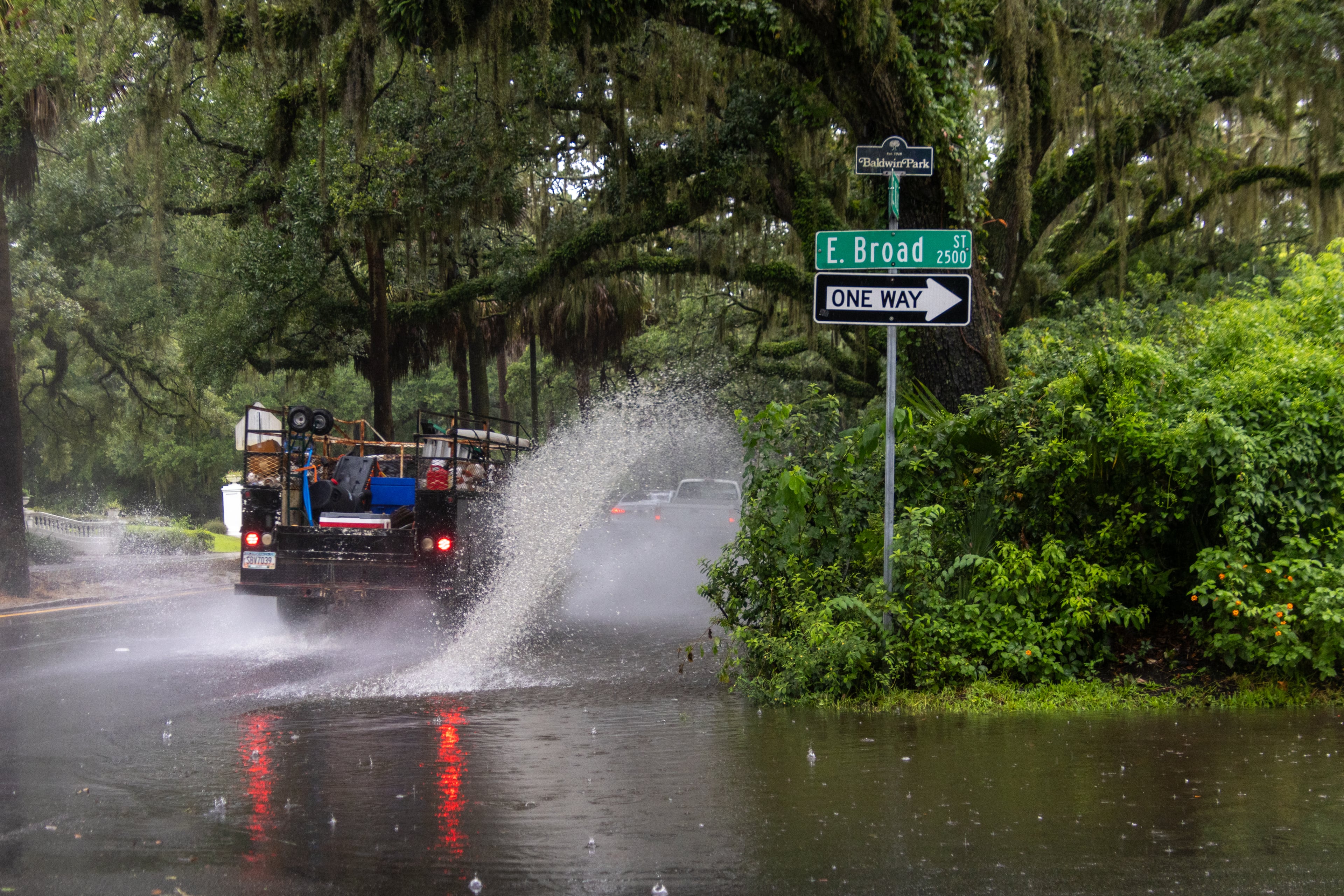
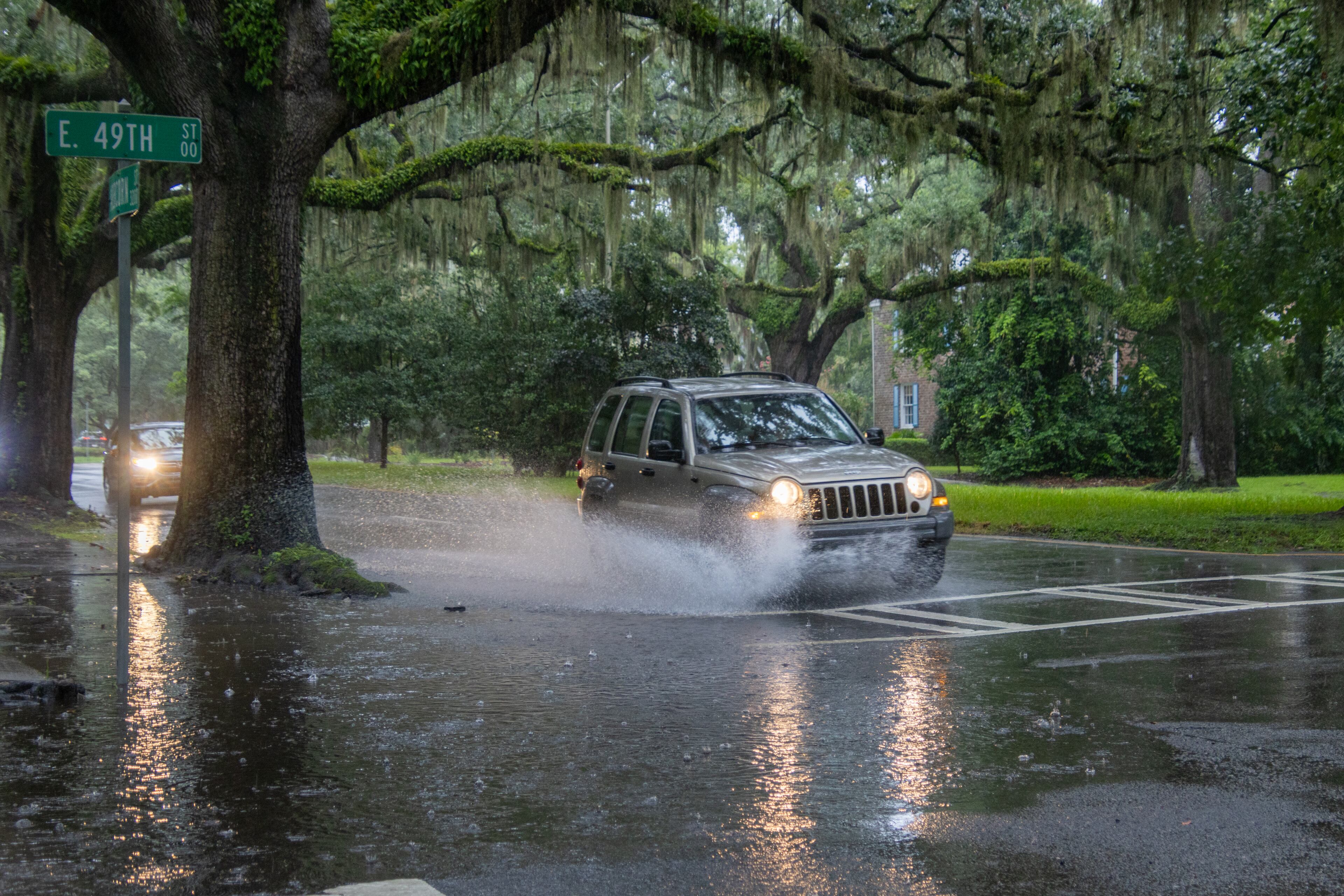
Dangerous storm surge conditions are expected along the Gulf and Atlantic coasts through the middle of the week, the NWS warns. Flash flooding is also expected along those coastlines.
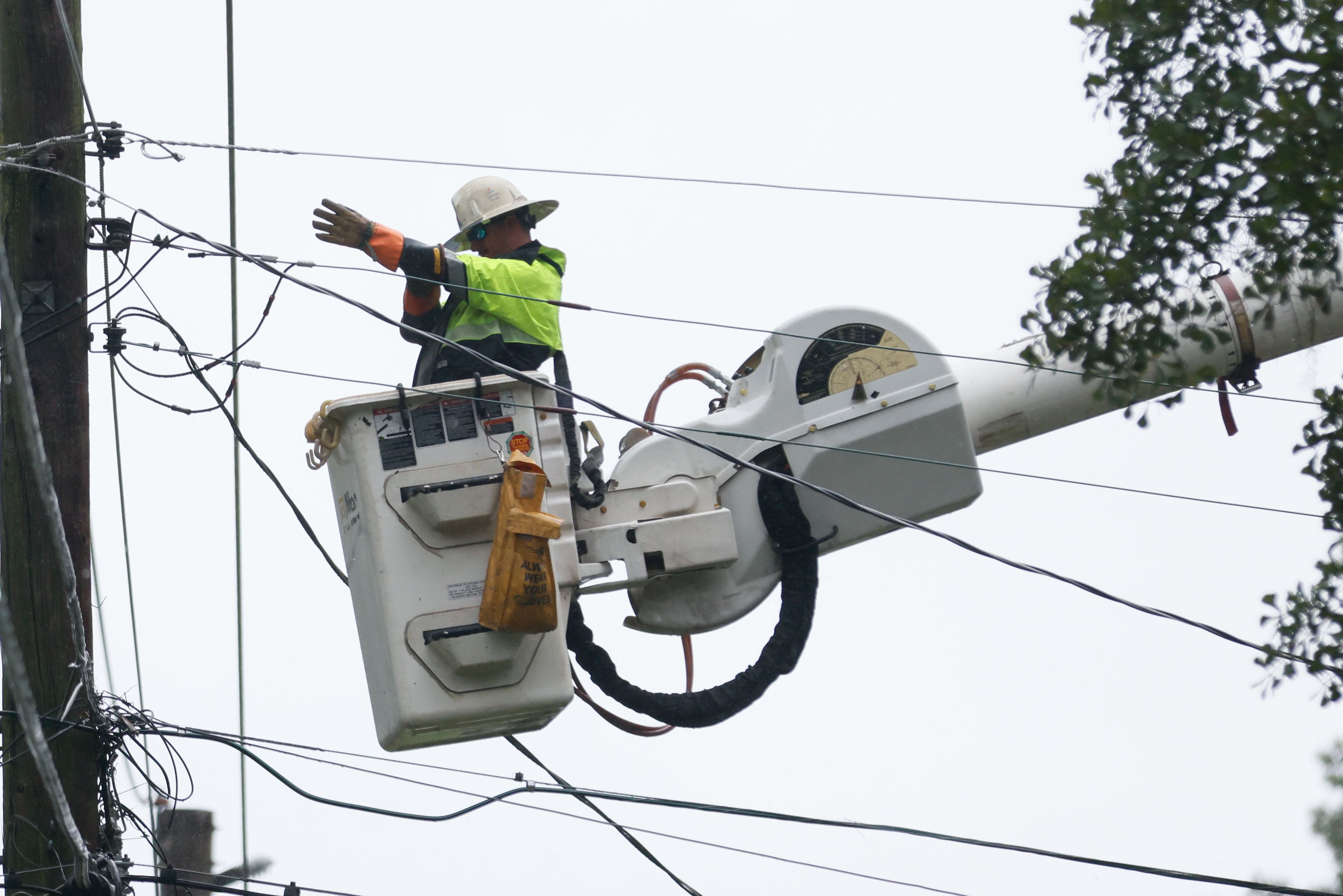
The flooding, along with strong winds, will bring down trees and powerlines, causing the potential for extended outages.
“Get out,” Georgia Emergency Management and Homeland Security Agency Director Chris Stallings said during a news conference Sunday evening.
“Get you and your family out ahead of time ... Just because the system isn’t a hurricane doesn’t mean that it’s not going to be impactful. Some of our most impactful floods have been tropical storms and tropical depressions here in Georgia,” he added.
Motorists should avoid driving into water that appears shallow. The water can be much deeper than expected, and currents could be swift enough to sweep vehicles from the road.
“This is a life-threatening situation,” the Hurricane Center warned. “Persons located within these areas should take all necessary actions to protect life and property from rising water and the potential for other dangerous conditions.”
As a result of the storm, Vice President Kamala Harris postponed her rally Friday in Savannah. She was set to headline with her yet-to-be-named running mate, part of a four-day swing through several battleground states.
It is the second time in less than a year that Valdosta and surrounding areas were expecting hurricane or tropical storm conditions. Hurricane Idalia brought damaging winds and flooding to the area last year.
As the core of Debby chugged toward Valdosta, there were moderate gusts of wind and rain. Locals like Jared O’Neal, whose power was out and whose home suffered $50,000 in damage last year during Idalia, were buying generators. The Lowe’s store on St. Augustine Road sold around 30 of them Monday morning.
“There is still a possibility to see some flooding rains with a total of 10 to 15 inches, which is what was forecasted,” Meghan Barwick, spokesperson for the Lowndes County Emergency Management Agency, said Monday afternoon. “We’re still heavy winds and some gusts. We’ve got power lines down, trees down. Nothing like Hurricane Idalia, but we still want our folks to be vigilant and stay off the roads and at home if they can. We haven’t gotten reports of extensive damage with trees through houses like we did with Idalia.”

In St. Simons, pounding rain and strong winds kept tourists and fisherman away from the main pier and nearby shops and restaurants Monday. Beaches were also deserted as residents and visitors still on the island prepared to hunker down.
The F.J. Torras Causeway, which connects Brunswick to St. Simons Island, remains open. According to a joint emergency declaration from Glynn County and Brunswick City commissioners, the causeway will remain open unless there are water hazards and flooding. The Sidney Lanier Bridge will remain open unless wind speeds reach 40 mph sustained. Any decision to close the bridge will be made by the Georgia Department of Transportation.
Glynn County and Brunswick are also opening an emergency shelter in Selden Park at 100 Genoa Martin Drive.
“The shelter’s first priority is to assist people displaced by high storm waters and flooding,” officials said.
While numerous restaurants on St. Simons Island are typically closed on Mondays, Southern Soul BBQ and sister eatery Frosty’s operate seven days a week. However, co-owner Griffin Bufkin opted to shut both of his restaurants Monday.
”The past three hurricanes that have come at us have done this behind the Gulf thing coming at us from the west. The part that really is the most dangerous is the nor’easter that comes with it,” Bufkin said.
Airlines have canceled hundreds of flights, including routes to and from cities in Florida. There were about 125 flights canceled at Hartsfield-Jackson International Airport Monday, according to FlightAware.com. That includes more than 70 Delta Air Lines and Delta Connection flights.
Delta issued a travel waiver for Fort Myers, Gainesville, Jacksonville, Key West, Sarasota, Tallahassee and Tampa, as well as Valdosta. It is allowing people who had flights booked to, from or through those cities over the weekend through Monday to reschedule their flights to avoid the impact of the storm without paying a higher fare, subject to certain conditions.
Joe Marinelli, president and CEO of Visit Savannah, the local convention and visitors bureau, said one saving grace of the storm impact is that it will hit the area during the early part of the week — a slower period for tourism, with no citywide conventions in town. Marinelli said he didn’t want to discourage people from visiting later in the week or next weekend.
”It will have some impact on those that were maybe planning to come into Savannah a couple days early (before the weekend) … but you know, this too shall pass,” he said.
Marinelli said he suspects some restaurants, tour operators and museums may close Tuesday and Wednesday, but he was not aware of any hotels in Savannah relocating guests.
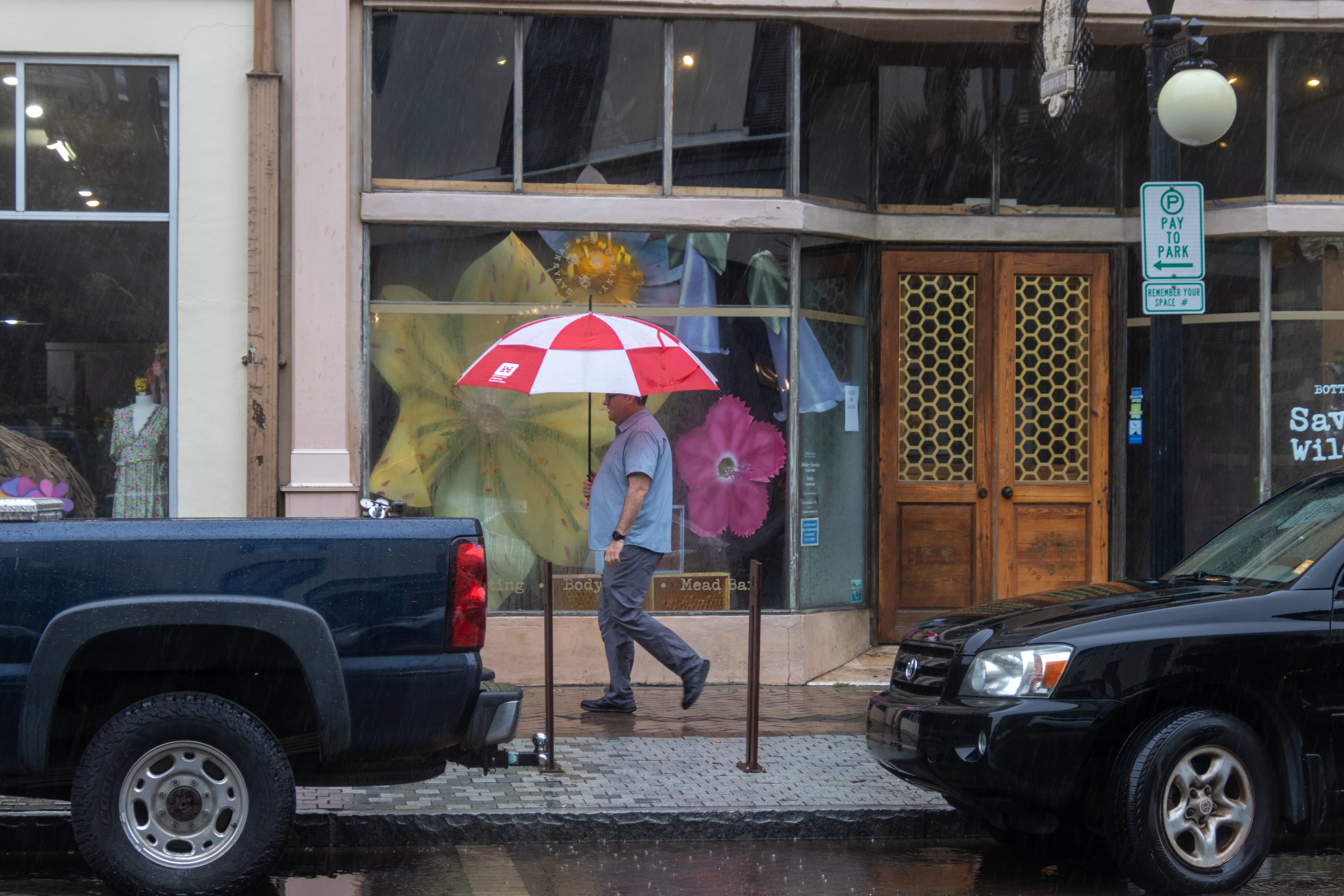
Marinelli said on Monday morning: “It’s raining right now, but nothing more than a normal rain. … The concern is that it’s going to rain nonstop for three days.”
— Staff writers Kelly Yamanouchi and Ligaya Figueras contributed to this article.
Hurricane Helene
Atlanta weather forecast and current conditions | Local weather radar
How you can help with Georgia storm assistance
Georgia statewide power outage map - live updating
Report power outages: Georgia Power Co. | EMCs for metro Atlanta
» Download The Atlanta Journal-Constitution app for news and latest weather alerts near you.
What we know about the victims in Georgia
Understanding the storm: Helene inflicted historic damage across Georgia
AJC video: After Hurricane Helene, repair and recovery begins in Georgia
Regional storm reports from Buckhead | Valdosta | Savannah | Dublin | Augusta | Western North Carolina
Helene storm photos from Atlanta and Georgia | Photos from North Carolina and Tennessee
» For a detailed forecast, visit www.ajc.com/weather.
» For updated traffic information, listen to News 95.5 and AM 750 WSB and follow @WSBTraffic on X.
» Download The Atlanta Journal-Constitution app for weather alerts on-the-go.