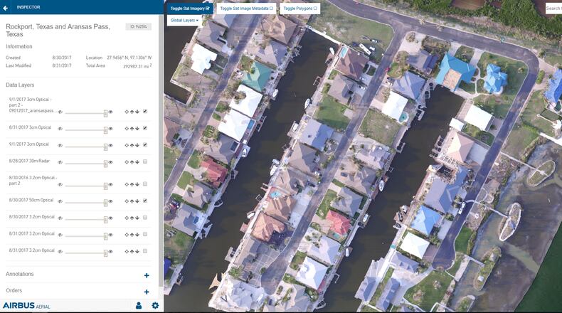
Airbus Aerial, an Atlanta-based subsidiary of Airbus, is offering insurance companies free access to some aerial maps and data for Hurricane Irma recovery.
Insurance companies can see maps of what an area looked like before a storm, and would have to pay extra to commission high-resolution satellite imagery of specific areas and drone or aerial images for a closer look.
Such images allow adjusters to see actual damage to a building or an area and prioritize the hardest-hit areas, according to Airbus. One goal is to more quickly settle claims.
“We are hopeful that it will change the way disaster recovery is done in the future,” said Airbus Aerial president Jesse Kallman in a written statement. “Our focus is on helping victims restore some sense of normalcy to their lives as quickly as possible.”
The company says it did similar work for insurers in Houston after Hurricane Harvey.
About the Author
Keep Reading
The Latest
Featured


