TRACKING IDALIA | Hurricane Idalia makes landfall in Florida as Category 3

Hurricane Idalia made landfall Wednesday morning as a Category 3 storm on Florida’s west coast.
The storm came ashore near Keaton Beach in the Big Bend region at 7:45 a.m. with maximum sustained winds of 125 mph, according to an advisory from the National Hurricane Center. Water levels along Florida’s Gulf Coast were rising rapidly.
On Idalia’s approach, sustained winds of 61 mph were recorded at Keaton Beach and water levels more than 5 feet above average were recorded at Cedar Key, according to the Hurricane Center. With the center of the storm moving inland, Idalia will weaken but is likely still to be a hurricane when it reaches southern Georgia later Wednesday.
Hurricane-force winds extend outward up to 25 miles from the center, and tropical-storm-force winds extend outward up to 175 miles. Hurricane warnings have been issued for several southeast Georgia counties and extend all along the Atlantic coast up to Edisto Beach, South Carolina.
Gov. Brian Kemp on Tuesday declared a state of emergency for Georgia to make all state resources available to assist in preparation, response and recovery operations for a period of 10 days.
For the Savannah area, forecasters predict sustained winds will peak at 80 mph, the equivalent of Category 1 hurricane force, with gusts up to 95 mph. Storm surge warnings are also in effect, with the potential of 2 to 4 feet of inundation within surge-prone areas through early Thursday morning.
Heavy rainfall, snapped trees and widespread power outages are expected along the coast.
“It’s going to have some big impacts as well in southeast Georgia and even into Middle Georgia,” Channel 2 Action News meteorologist Brian Monahan said of Idalia’s destructive winds and rain bands. “For us, really no significant impacts from this storm.
“We’re going to see some more rain, were going to see some more storms and it’ll be gusty wind today, but all things we can handle,” he said.
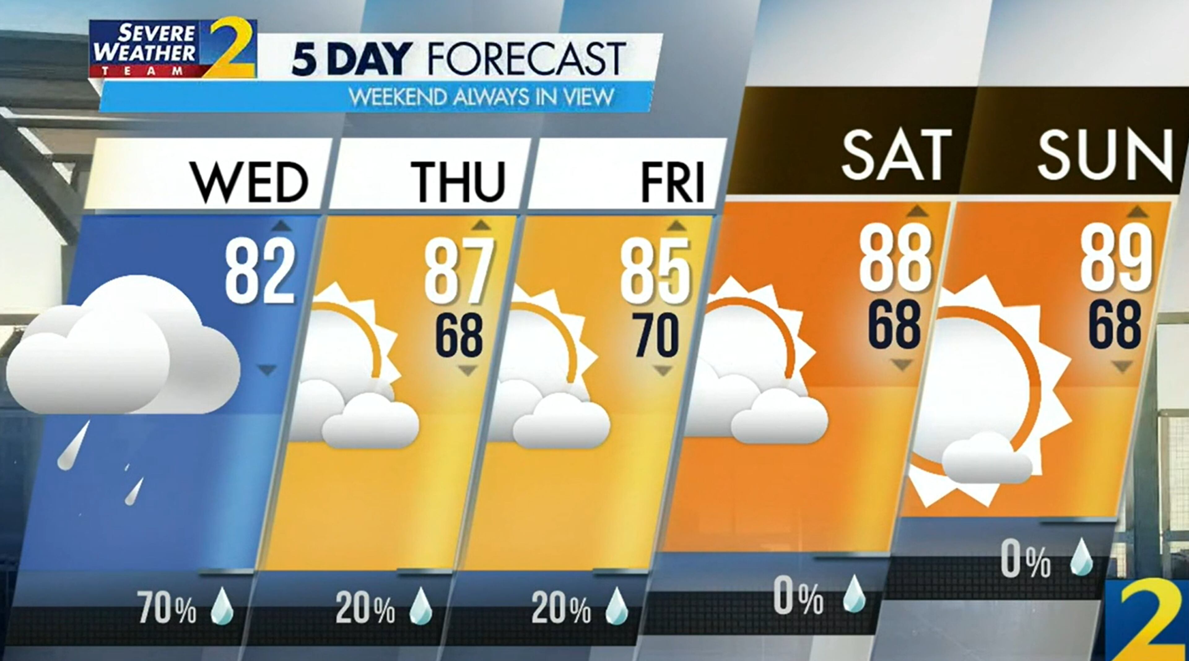
A 70% chance of rain and isolated storms is in metro Atlanta’s forecast Wednesday, but it won’t be associated with the tropical system. The pattern should be similar to the past several days, with downpours cropping up around the evening drive and the possibility of flash flooding.
Wind from Idalia should pick up later Wednesday, but tropical-storm-force gusts are not expected to reach the city. Monahan is predicting wind speeds will top out at 35 mph, especially in the southern suburbs. Those communities are most likely to see heavy rain from Idalia’s outer bands, depending on the storm’s track.
Most of the heavy rain will stay in southeast and Middle Georgia, he said.
“As we often see behind these tropical systems, it moves away, much drier air comes in and then we’re set up for what’s going to be a really nice Labor Day weekend,” Monahan said, calling for low humidity, highs in the upper 80s to low 90s and limited rain chances.

» For a detailed forecast, visit The Atlanta Journal-Constitution weather page.
» For updated traffic information, listen to News 95.5 and AM 750 WSB and follow @wsbtraffic on Twitter.
» Download The Atlanta Journal-Constitution app for weather alerts on-the-go.


