Even as Hurricane Irma moves through Georgia and shifts further west, thousands of homes on coastal Georgia are still at the risk of flooding.
The Federal Emergency Management Agency categorizes land pockets all over the country as Special Flood Hazard Areas i.e. land that is prone to flooding. AP recently released data containing the number of housing units covered under the National Flood Insurance Program and the number of housing units located in potential flood hazard areas.
Using these numbers and housing units data from the 2010 Census, we calculated the percentage of homes in each county that are at risk of flooding. Using the map below, tap or mouse over a county to get more details.
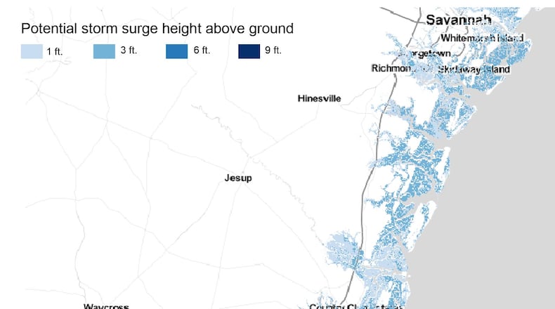
The National Hurricane Center also releases data on potential storm surge flooding. The map below shows areas in coastal Georgia that are at risk of storm surges.
Source: Associated Press, 2010 Census. We used 2010 Census numbers since AP also used 2010 data to calculate the number of housing units in flood hazard regions.
Keep Reading
The Latest
Featured


